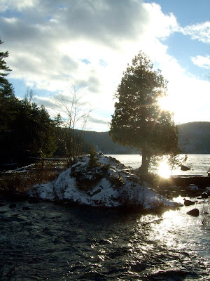
I am not going to bore you with every run I do, but this one was a lot of fun and I stopped often to take pictures.
I decided beforehand to park at P7 (Kingsmere) and run up #30 to #1 and then take #4 to #32, after that #36 to Lac Meech and then turn around and come back the way I came. As you will see from the map below I took a wrong turn and ended up running past Ski Camp Fortune before getting back on track and joining #36 (the right-hand portion of what looks like a loop). I figured it out and came back the right way, but the sign-posting is not that good at that intersection on the trails.
Plenty of ups and downs, #36 and #32 were pretty steep and then the first part of #4 coming back was a killer.
Looking up #4, the incline was severe and a good dusting of snow, but my trusty Hawk-2's didn't let me down.
Coming down #4 just before I made my wrong turn.
Found this rather nice stream while I was looking for #32 by Ski Camp Fortune. Unfortunately as I found out on the way back, #32 was actually on the other side of the hill.
Someone on Running Mania posted about this great bridge over a small inlet of Lac Meech. I stopped here for a while and enjoyed the views. A fantastic little quiet spot on trail #36 just after the O'Brien Beach car park (heading towards #50).
Another shot of Lac Meech from the bridge. It was about minus 5°C and sunny, great day for running trails.
Sun was starting to go down over Lac Meech, this was my cue to head back to Kingsmere. I was 8 kilometers away from my start-point, so I had plenty time but I didn't want to push my luck too much.
It really is a great little spot. If you are local to the National Capital Region (or in the area) you can drive up to O'Brien Beach car park (Gatineau Park Trail Map) and the bridge is about 1 kilometer down the trail (there is a bit of up hill and a huge downhill stretch, so be warned).
This is trail #32 heading up to the summit before heading down towards Lac Fortune. It is here that my left knee started to hurt. I think the hard fast downhills on hard frozen ground had taken their toll. I managed to get to an intensity level that allowed me to get back to Kingsmere before the sun went down, although the final 1 kilometer downhill stretch was a killer. The knee is fine now, just iced it and rested it up. However, this serves as a warning to put a few extra items in my pack (headlamp, extra food, some warmer clothes etc.) next time just in case.
Total mileage for this run was 15.42 kilometers with ~500 meters (~1600 feet) of elevation gain. Hopefully I will get another opportunity to run again up there before the snow makes it too difficult, I fancy checking out the rest of #36 towards #50 and #52.


No comments:
Post a Comment